Geographic Information System ( GIS )
A Geographic Information System ( GIS ) is an information system designed to collect, store, process, analyze, manage and present all types of spatial and geographic data.
Generally, GIS is an information system that integrates, stores, analyzes and shows geographic information.
So, GIS applications allow users to create interactive inquiries, analyze spatial information, edit data using maps as well as to map them graphically.
It also refers to a number of technologies, processes and methods.
However, they are not only closely linked to spatial planning, but also to infrastructure and network management. Transport and logistics, insurance, telecommunications, engineering, planning, education and research connect to GIS also.
As such, GIS are at the origin of many geolocation services based on data research and visualization.
So, the app allows to search waypoints by name and coordinates.
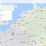
Thus, navigate a fully-featured map, view addresses as well as coordinates at double-clicking on the map.
Also, save route information in KML format.

After all, GIS is more than just a software. People and methods connect to geospatial software and tools. Yet, this allows spatial analysis, manage large datasets, and show information in a map or graphical form as well.
For more information, go the cartographic service with Startouch Maps application by Startouch.
Also, GIS allows the linking of data that can, on paper, seem very far apart. There are different ways to identify and represent the objects and events that portray our environment. For example, coordinates, latitude & longitude, address, altitude, time, social media, etc. GIS brings together all these dimensions around the same reference system, which is the foundation of the information system.
Up-to-date legend, high quality unit visualization and all the necessary map layers.

Allows to adjust address data display format to clients needs.

Optimal route between waypoints, estimated time and distance calculations.

Posted speed limit detection based on GIS data.

Startouch Maps Advantages
- Partnership with major cartographic services
- Personal maps disposition with limited access
- Customized for mobile client
- Regular updates of mapping data
- Popular vector formats support (shape, mapinfo, mp and etc.)
- GIS administrative capabilities and Startouch technical support
